Friday, November 19, 2010

Your History of Mount Pleasant

Commercial Corridor Database Available for Public Interpretation

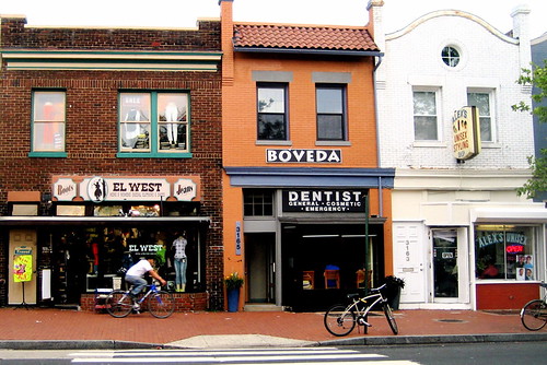
Image Credit: M.V. Jantzen, Flickr Mount Pleasant, DC Group Pool
Learn more about this project at our 4th Annual DC Community Heritage Project Showcase on Wednesday, December 8. You are guaranteed to learn something new about DC at this FREE program and reception! RSVP today http://bit.ly/hd8jtS


Mt. Pleasant's cheerful collection of bodegas, bars, and beauty salons along its main commercial thoroughfare cut a striking contrast to the national chains just two blocks east in Columbia Heights. Like the apartments and houses in the residential areas of Mt. Pleasant, the commercial corridor and the progression of businesses that have occupied its storefronts are part of a narrative of cultural change and population shift.

Historic Mount Pleasant (HMP), the local organization dedicated to preserving the architectural heritage of the neighborhood, recently received a grant from the Humanities Council of Washington, DC to create an in-depth study of the Mt. Pleasant commercial corridor. Working with records from the National Archives and Records Administration, the Washingtoniana Collection at the DC Public Library, the DC Recorder of Deeds, and the Historical Society of Washington, DC, HMP developed databases of historic building permits, and “chain of title” for historic commercial properties. The “chain of title” report lists past owners of many commercial properties from their construction to the present day.

1919 Baist Map of the
Commercial Corridor
The narrative, which largely covers the years between 1904 and 1938, depicts a bustling streetcar suburb in which “over one-third of the spaces had housed grocery stores; another 8 delicatessens; 4 bakers or confectioners, and 3 restaurants.” An additional 20 storefronts housed clothing-related businesses. The database reveals that during the early 20th century, the commercial corridor of Mount Pleasant focused heavily on the immediate needs of neighborhood residents, and was the basis of a self-sufficient community. When Ward 1 experienced a large influx of immigrants from Central and South America after the 1960s, the character of the neighborhood changed, but the dedication to meeting the needs of a thriving urban neighborhood did not. The grocery stores and delicatessens became bodegas and tiendas latinas, and the commercial corridor reflected the diversity and dynamism of the neighborhood.

Even a brief glance at the raw data raises powerful questions about the history of the neighborhood, and about urban development in general. The largely quantitative study is available at Historic Mount Pleasant's website and the narrative is cataloged as part of the Humanities Council's DC Digital Museum. Examine the documents and let us know what questions, themes, patterns, and ideas seem to be begging for in-depth analysis. Leave a comment on the blog or write to Jasper Collier, Curator of the DC Digital Museum at, jcollier[at]wdchumanities[dot]org.

No comments:

Post a Comment